Provence Wine Map: Every Appellation, Region And Driving Distance Explained
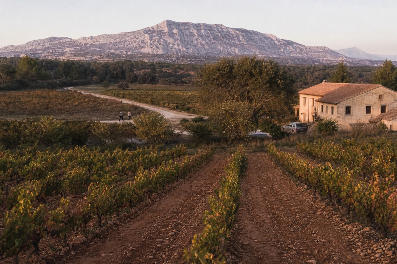
Provence is not one wine region but a ring of them, from the Rhône villages north of Avignon to the coastal cliffs of Cassis and Bandol, and the distances between them decide which tour actually makes sense.
Short answer
A wine map of Provence shows nine main appellations spread across roughly 150 km: Châteauneuf-du-Pape sits 17 km from Avignon, Cassis 26 km from Marseille, and the Côtes de Provence heartland is about 100 km from Aix. Provence made 89% rosé in 2024, and the 2024 harvest totalled 1,130,139 hl.
What Does A Wine Map Of Provence Actually Show?
A wine map of Provence shows nine principal appellations arranged in an arc: the Rhône villages of Châteauneuf-du-Pape, Gigondas and Vacqueyras in the north, Coteaux d'Aix-en-Provence and Luberon in the centre, Les Baux and Cassis on the western and southern coast, Bandol on the Mediterranean, and the sprawling Côtes de Provence across the interior and coast alike.
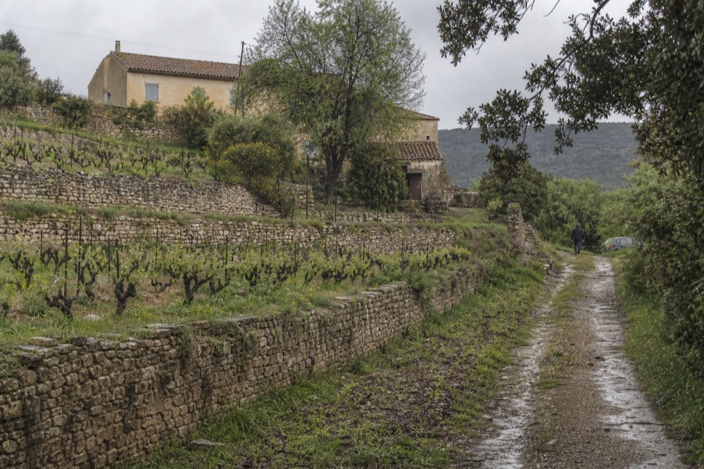
The single most useful thing a map tells you, and the thing most first-time visitors miss, is that "Provence wine" is not one thing (see Aix Must-Sees). The three AOPs the official interprofession calls "Vins de Provence", Côtes de Provence, Coteaux d'Aix-en-Provence and Coteaux Varois en Provence, account for the bulk of production and the famous pale rosé. But Bandol, Cassis, Les Baux-de-Provence, Palette and Bellet are separate appellations with separate rules, and the Rhône-side names, Châteauneuf-du-Pape, Gigondas and Vacqueyras, are administratively Rhône valley appellations even though every tour operator in Avignon sells them as a Provence day out.
That distinction matters when you read statistics. Provence, in the CIVP's strict sense of the three AOPs, produced 1,130,139 hectolitres in the 2024 vintage, of which 89% was rosé, 6% white and 5% red. Those figures do not include Bandol or Cassis at all, and any percentage presented as covering "all of Provence" including those two is simply wrong. A good map keeps the boundaries honest.
It also keeps distances honest. Châteauneuf-du-Pape is 17.4 km from Avignon by road but 89.3 km from Aix-en-Provence, a fact that should shape which tour you book from which town. This guide walks the map region by region, with the real driving figures, so you can match the ground to your base.
Where Are The Main Wine Regions Of Provence On The Map?
The main regions run in a rough crescent from north-west to south-east: Châteauneuf-du-Pape, Gigondas and Vacqueyras sit north-east of Avignon; Coteaux d'Aix-en-Provence rings Aix; Les Baux and Luberon lie west and east of Aix respectively; Bandol and Cassis sit on the coast south of Marseille and Toulon; and Côtes de Provence spreads across the Var from the Sainte-Victoire mountain to Fréjus.
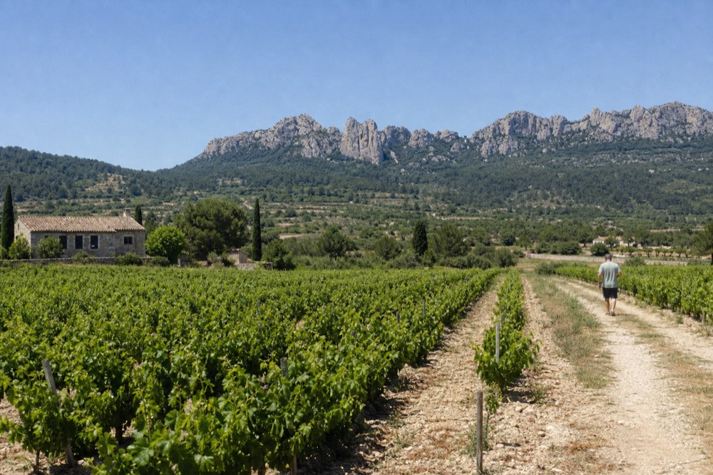
Each appellation has its own recognition date, its own permitted grapes and its own character, and the table below is the map in list form. Recognition dates come from each appellation's official INAO specification.
| Appellation | AOC granted | Where it sits | What it is known for |
|---|---|---|---|
| Cassis | 15 May 1936 | Coastal, east of Marseille | White-dominant, about 70% of production |
| Châteauneuf-du-Pape | 15 May 1936 | North-east of Avignon | Blends of up to 13 (or 18) varieties |
| Côtes de Provence | 24 October 1977 | Across the Var and beyond | Rosé-led; 71% of the 2024 Vins de Provence harvest |
| Bandol | 11 November 1941 | Coast west of Toulon | Mourvèdre reds aged 18 months minimum |
| Coteaux d'Aix-en-Provence | 24 December 1985 | Ring around Aix | Rosé and structured reds |
| Vacqueyras | 1990 | Rhône, near Gigondas | Grenache-based reds |
| Luberon | 26 February 1988 (as Côtes du Luberon) | East of Aix | Reds, rosés and whites |
| Les Baux-de-Provence | 20 April 1995 | Alpilles, south of Avignon | Small, structured reds and rosés |
| Gigondas | 6 January 1971 | Rhône, below Vacqueyras | Powerful reds, and white as well as rosé |
Two of those dates carry a story worth knowing. Cassis and Châteauneuf-du-Pape were among France's first six wine AOCs, all decreed on 15 May 1936, alongside Arbois, Cognac, Monbazillac and Tavel, as the INAO's own anniversary record confirms. And a correction you will meet often: the claim that Châteauneuf-du-Pape "was the first AOC, in 1923" is legend. What 1923 actually was, per the official specification, is the year growers founded the first syndicate to defend the origin under Baron Le Roy de Boiseaumarie. The AOC itself came in 1936, and it was one of six, not one of one.
If you are planning to cover this ground with a guide rather than a hire car, the trio below spans the map well: a full small-group day from Nice into the Côtes de Provence heartland, a hotel-pickup alternative from the same coast, and a short tasting route from Aix for the days you want the Coteaux d'Aix side.
How Far Is Each Wine Region From The Main Towns?
Real road distances put Châteauneuf-du-Pape 17.4 km from Avignon but 89.3 km from Aix-en-Provence, Cassis 25.7 km from Marseille, and the Côtes de Provence heartland around Les Arcs-sur-Argens 99.5 km from Aix and 85.6 km from Nice. The map looks compact; the driving is not.
These figures come from road routing over the OpenStreetMap network, city centre to village centre, and they are free-flow times. They do not include August coastal traffic, a busy Saturday on the A8, or the time a car actually spends parked at a cellar, so treat them as the floor, not the promise.
| Route | Road distance | Free-flow driving time |
|---|---|---|
| Avignon to Châteauneuf-du-Pape | 17.4 km | 23 min |
| Avignon to Les Baux-de-Provence | 30.7 km | 40 min |
| Avignon to Vacqueyras | 34.5 km | 39 min |
| Avignon to Gigondas | 46.7 km | 44 min |
| Marseille to Cassis | 25.7 km | 33 min |
| Marseille to Bandol | 54.9 km | 49 min |
| Aix to Puyloubier (Sainte-Victoire) | 24.5 km | 31 min |
| Aix to Châteauneuf-du-Pape | 89.3 km | 67 min |
| Aix to Les Arcs-sur-Argens | 99.5 km | 75 min |
| Nice to Les Arcs-sur-Argens | 85.6 km | 68 min |
| Nice to Saint-Tropez | 111.9 km | 98 min |
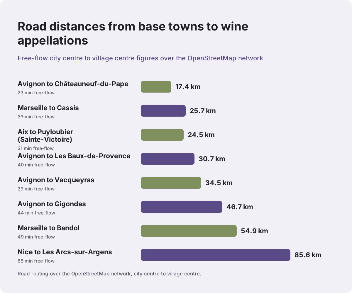
The honest-broker line this table pays for: a "Châteauneuf-du-Pape from Aix" tour is a real thing, but it is nearly a 90 km drive each way before anyone tastes anything, and buyers should be told so before they book. The same logic favours the coast for the Côtes de Provence and favours Avignon, decisively, for the Rhône villages.
One more map-reading note: the distances also explain why so many tours from Nice and Cannes are full days. The 8-Hour Small Group tour from Nice at $208.36 per person, rated 4.9 across 384 reviews, spends much of that time legitimately on the road, because the vineyards it visits are 85.6 km and more from the pick-up point. That is geography, not padding.
What Is The Côtes De Provence And Where Does It Sit?
Côtes de Provence is the giant of the map: 20,300 hectares across 84 communes in three departments, 68 in the Var, 15 in the Bouches-du-Rhône and one in the Alpes-Maritimes, recognised by the decree of 24 October 1977, and producing 71% of the three Provence AOPs' combined harvest in 2024.
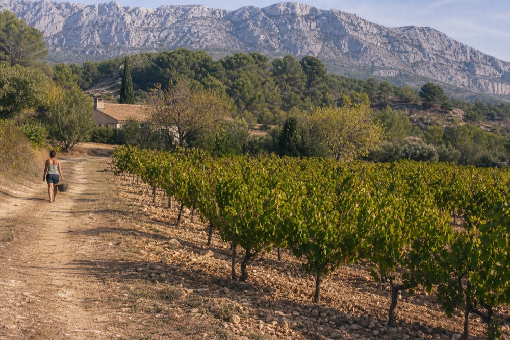
On any wine map of Provence, Côtes de Provence is the big central and eastern mass, and within it sit five named sub-denominations: Sainte-Victoire, Fréjus, La Londe, Pierrefeu and Notre-Dame des Anges. These are not marketing labels. The specification caps the maximum average parcel load at 9,500 kg per hectare for plain Côtes de Provence but 8,500 kg per hectare for all five sub-denominations, a concrete, checkable yield discipline that separates a Sainte-Victoire bottle from a generic one. Four of the five, Sainte-Victoire, Fréjus, Pierrefeu and Notre-Dame des Anges, are reserved for red and rosé only; La Londe is the only one that also covers white.
The grapes tell you what to expect in the glass. The principal varieties for reds and rosés are cinsault, grenache, mourvèdre, syrah and tibouren, and tibouren is the one worth asking about at the cellar door, because it is local to Provence and appears on the principal list here rather than as a footnote. The CIVP records 51% of the appellation's area as organic or HVE certified, which is a striking figure for an appellation this size.
For visitors, the practical access points are Aix-en-Provence to the west and the coast to the south-east. The Sainte-Victoire sub-denomination is the easiest to reach from Aix: Puyloubier, one of its key communes, is 24.5 km and about 31 minutes from the city centre. A short tasting tour is the low-commitment way to see it, and the Sainte-Victoire Route from Aix runs 3 hours at $114.97 per person, rated 4.8 across 273 reviews, tastings included.
Where Do Bandol And Cassis Fit On The Map?
Bandol and Cassis are the two coastal appellations on the southern edge of the map: Cassis is a small white-dominant appellation 25.7 km east of Marseille, and Bandol is a mourvèdre specialist spread across eight communes west of Toulon, 18.7 km from that city and 54.9 km from Marseille.
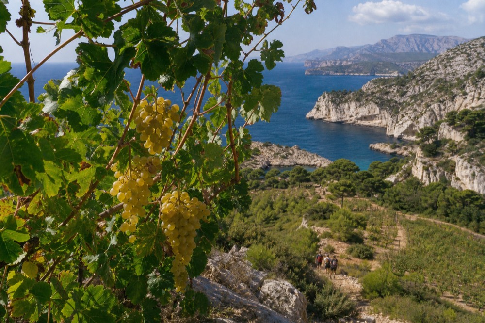
These two break every Provence stereotype, and the map explains why. Cassis, the appellation, is officially white-dominant: the INAO specification states that white wine represents about 70% of total production, built principally on clairette and marsanne, with marsanne required at 30% to 80% of the white plantings. In a region whose headline figure is 89% rosé, Cassis is the appellation that went the other way, and its whites are the natural pairing with the local bouillabaisse-style seafood.
Bandol is the opposite pole: red country. Its specification requires mourvèdre at between 50% and 95% of the plantings for reds, and the reds must be aged a minimum of 18 months in barrel or foudre, the single hardest rule separating Bandol from the rest of Provence. The rosés must carry at least 20% mourvèdre, often 30% to 40% per the INAO's own text. The eight communes, all in the Var, are Bandol, Le Beausset, La Cadière-d'Azur, Le Castellet, Évenos, Ollioules, Sanary-sur-Mer and Saint-Cyr-sur-Mer.
For tour planning, the geometry is friendly if you are near Marseille or Toulon and unfriendly almost everywhere else. From Aix, the drive to the Bandol coast is long enough that the half-day Bandol and Cassis tour from Aix, 5 hours at $121.94 per person and rated 4.9 across 11 reviews, is doing serious mileage to deliver both appellations in one morning. From Marseille, the Aix Countryside and Luberon full days are the closer options at 7.5 hours.
Where Is Châteauneuf-du-Pape On The Map?
Châteauneuf-du-Pape sits at the northern edge of the Provençal map, 17.4 km north-east of Avignon, and it is administratively a Rhône valley appellation rather than one of the three Provence AOPs, recognised by the decree of 15 May 1936 as one of France's first six wine AOCs.
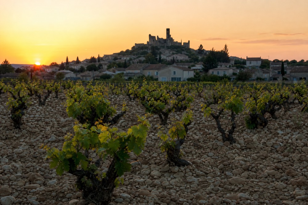
Its famous grape count is a map footnote worth getting right. The current specification names 18 entries for red and white; the traditional count of 13 collapses the colour mutations of clairette, grenache and piquepoul, each of which appears in two or three colour forms. Both numbers are right, and any explanation that gives one without the other is half a story. The appellation covered about 3,200 hectares in 2010, farmed by 320 holdings, per the specification's own snapshot.
The neighbours matter too. Gigondas, 46.7 km from Avignon and an AOC since 6 January 1971, makes powerful reds and, since its 2023 specification, white as well. Vacqueyras, 34.5 km from Avignon and recognised in 1990, is a grenache-led appellation whose vineyard grew from 580 hectares in 1950 to 1,462 hectares in 2009. A wine map that shows these three together is showing you the compact northern cluster that Avignon-based tours exploit so well.
That compactness is why the Rhône-side options dominate the Avignon departure list. The half-day Châteauneuf-du-Pape tour runs 4 hours at $103.36 per person, rated 4.8 across 456 reviews, while the Three-Estates full day stretches to 7 hours at $207 per person with a 5 rating across 553 reviews; both include tastings in the price. If you want Gigondas in the same day, the private Gigondas and Châteauneuf-du-Pape option covers 8 hours at $1,219.42 per group of up to 8, though tastings are paid separately at the cellar door on that one.
Where Do Luberon, Les Baux And Coteaux d'Aix Sit?
Luberon lies east of Aix, with Lourmarin 40.1 km and Bonnieux 50.0 km from the city; Les Baux-de-Provence sits in the Alpilles 30.7 km south of Avignon and 71.6 km from Aix; and Coteaux d'Aix-en-Provence forms the ring around Aix itself, recognised on 24 December 1985.
These three fill the centre-west of the map, and each carries a caveat worth knowing. Luberon, first recognised as "Côtes du Luberon" on 26 February 1988 and renamed simply "Luberon" by the decree of 18 September 2009, is administratively a Rhône valley appellation, not one of the three CIVP "Vins de Provence" AOPs, even though it is sold to visitors as a classic Provence day out. It covered about 3,300 hectares in 2010, and its full-day tours from Aix, such as the 10-Hour Luberon Villages and Wine at $209.04 per person, rated 4.9 across 65 reviews, pair the vineyards with the villages.
Les Baux-de-Provence is the small appellation in the Alpilles, independent since 20 April 1995 after beginning as a sub-denomination of Coteaux d'Aix. Its specification caps yield at 50 hl/ha with a maximum average parcel load of 8,500 kg/ha and a minimum planting density of 4,000 vines per hectare. What it does not publish, and what no primary source states, is a planted-hectare figure or an appellation-level organic percentage, so treat any number you see for those with suspicion.
Coteaux d'Aix-en-Provence is the appellation you are standing in whenever you taste within half an hour of Aix. It covered more than 4,100 hectares in 2009, shared between 12 cooperative cellars and 70 private estates, and its permitted-grape list has an unusual entry: cabernet-sauvignon appears as an accessory variety, which is rare for Provence. The half-day Coteaux d'Aix tour from Aix runs 4.5 hours at $121.94 per person, rated 4.7 across 25 reviews, and the Cézanne Country tasting route covers similar ground in 3 hours.
Which Wine Map Of Provence Should You Use For Planning A Tour?
Use the map backwards from your base town: from Avignon book the Rhône villages, from Marseille book Cassis and Bandol, from Aix book Coteaux d'Aix, Sainte-Victoire or the Luberon, and from Nice and Cannes book the long full days into the Côtes de Provence, because every other region is a round trip measured in hours from the coast.
The table below is the planning layer of the map: which base puts which appellation within a sensible half-day or full-day radius, and what a representative small-group tour from that base costs. Prices and ratings are per person and come from the live listings; tastings are included in the price on all of these.
| Base town | Closest appellations | Representative tour | Price | Rating |
|---|---|---|---|---|
| Avignon | Châteauneuf-du-Pape, Gigondas, Vacqueyras | Three-Estates Châteauneuf-du-Pape Day, 7 hours | $207 | 5 across 553 reviews |
| Aix-en-Provence | Coteaux d'Aix, Sainte-Victoire, Luberon | Cézanne Country, Côtes de Provence, 3 hours | $117.01 | 4.9 across 288 reviews |
| Marseille | Cassis, Bandol, Aix countryside | Luberon Full Day, 7.5 hours | $184.66 | 4.9 across 41 reviews |
| Nice | Côtes de Provence heartland | 8-Hour Small Group, From Nice | $208.36 | 4.9 across 384 reviews |
| Cannes | Côtes de Provence heartland | 8-Hour Small Group, From Cannes | $207.88 | 4.9 across 56 reviews |
There is a legal layer to the map too, and it is the honest reason driven tours exist at all. France's drink-driving limit is 0.5 g/L of blood, but a probationary-licence holder, which means anyone who passed their test within the last three years, or two after accompanied driving, is held to 0.2 g/L, effectively zero glasses. A hired car and a tasting day simply do not mix for those drivers, and Service-Public states the limits plainly. For everyone else, a guided small group removes the arithmetic from the day.
Season is the final map filter. The harvest starts in the earliest parcels in the second half of August and runs into September, with later sectors picking through mid-September, so late summer visits overlap with the busiest vineyards. The mistral, the dry north wind that averages around 50 km/h with gusts of 80 to 100 km/h, is strongest in winter and spring and hits the Avignon and Châteauneuf-du-Pape side hardest, so a windproof layer is worth packing for a spring Rhône tasting even though mistral days are dry and usually very sunny.
For the coastal bases, the small-group full day from Nice is the tour that most directly turns this map into a day out, and it is the one this site's Provence Wine Tours coverage points coast-based visitors toward first. You can read more about the individual appellations in the Côtes de Provence guide, the Bandol and Cassis tour guide, and the Châteauneuf-du-Pape tours guide, each of which zooms into one corner of the map.
If your dates are still flexible, the trio below repeats the three formats worth comparing: the Nice small-group day, the Nice full day with hotel pickup, and the short Aix tasting route for the inland half of your trip. All three include tastings in the price and carry free cancellation.
The questions readers ask most about the wine map of Provence are about boundaries and distances: whether Châteauneuf-du-Pape counts as Provence, how far each region is from the main towns, and which base puts you closest to the wines you actually want to taste. The answers below take each one in turn, using the same road distances and appellation facts carried through the rest of this guide.
Common Questions About The Provence Wine Map
What Are The Main Wine Regions On A Provence Wine Map?
The nine principal appellations are Côtes de Provence, Coteaux d'Aix-en-Provence, Coteaux Varois en Provence, Bandol, Cassis, Les Baux-de-Provence, Luberon, Palette and Bellet, plus the Rhône-side names of Châteauneuf-du-Pape, Gigondas and Vacqueyras that sit at the northern edge and are usually visited from Avignon.
How Far Is Châteauneuf-du-Pape From Avignon?
17.4 km by road, about 23 minutes in free-flow traffic. From Aix-en-Provence the same village is 89.3 km and about 67 minutes, which is why Rhône tours overwhelmingly depart from Avignon.
Is Provence Wine All Rosé?
The three Provence AOPs produced 89% rosé, 6% white and 5% red in the 2024 vintage. But the map is not uniform: Cassis is officially about 70% white, and Bandol is defined by mourvèdre-based reds aged at least 18 months in barrel or foudre.
Which Town Is The Best Base For A Provence Wine Tour?
Match the base to the appellation: Avignon for Châteauneuf-du-Pape and the Rhône villages, Aix-en-Provence for Coteaux d'Aix, Sainte-Victoire and the Luberon, Marseille for Cassis and Bandol, and Nice or Cannes for full-day trips into the Côtes de Provence heartland.
Does The Provence Wine Map Include Châteauneuf-du-Pape?
Geographically it sits at the northern edge of the region and every Avignon tour operator sells it as a Provence day out, but administratively it is a Rhône valley appellation, not one of the three CIVP "Vins de Provence" AOPs, so it is excluded from the Provençal rosé statistics.
What Is The Closest Wine Region To Marseille?
Cassis, at 25.7 km and about 33 minutes by road, followed by Aix-en-Provence at 31.8 km. Bandol is 54.9 km from Marseille but only 18.7 km from Toulon, so Toulon-based visitors are actually closer to it.